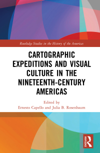
Buy Cartographic Expeditions and Visual Culture in the Nineteenth-Century Americas 1st Edition PDF ebook by author Ernesto Capello; Julia B. Rosenbaum – published by Routledge in 2021 and save up to 80% compared to the print version of this textbook. With PDF version of this textbook, not only save you money, you can also highlight, add text, underline add post-it notes, bookmarks to pages, instantly search for the major terms or chapter titles, etc.
You can search our site for other versions of the Cartographic Expeditions and Visual Culture in the Nineteenth-Century Americas 1st Edition PDF ebook. You can also search for others PDF ebooks from publisher Routledge, as well as from your favorite authors. We have thousands of online textbooks and course materials (mostly in PDF) that you can download immediately after purchase.
Note: e-textBooks do not come with access codes, CDs/DVDs, workbooks, and other supplemental items.
eBook Details:
Full title: Cartographic Expeditions and Visual Culture in the Nineteenth-Century Americas 1st Edition
Edition: 1st
Copyright year: 2021
Publisher: Routledge
Author: Ernesto Capello; Julia B. Rosenbaum
ISBN: 9780367333263
Format: PDF
Description of Cartographic Expeditions and Visual Culture in the Nineteenth-Century Americas 1st Edition:
During the nineteenth century, gridding, graphing and surveying proliferated as never before as nations and empires expanded into hitherto “unknown” territories. Though nominally geared toward justifying territorial claims and collecting scientific data, expeditions also produced vast troves of visual and artistic material. This book considers the explosion of expeditionary mapping and its links to visual culture across the Americas, arguing that acts of measurement are also aesthetic acts. Such visual interventions intersect with new technologies, with sociopolitical power and conflict, and with shifting public tastes and consumption practices. Several key questions shape this examination: What kinds of nineteenth-century visual practices and technologies of seeing do these materials engage? How does scientific knowledge get translated into the visual and disseminated to the public? What are the commonalities and distinctions in mapping strategies between North and South America? How does the constitution of these lines reorder space and the natural landscape itself? The volume represents the first transnational and hemispheric analysis of nineteenth-century cartographic aesthetics, and features the multi-disciplinary perspective of historians, geographers, and art historians.


